Services
Our main focus is the environmental consulting industry, providing the following specific services
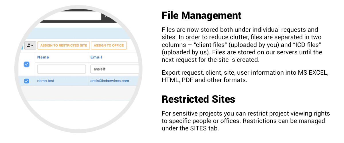
Drafting services
Site Maps and Aerial Maps
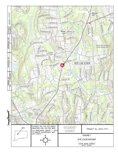
Site Location Maps
Site Vicinity Maps
Groundwater Elevation Contour Maps
Groundwater and Soil Analytical Figures
Geologic Cross Sections
Boring Logs
Create boring log templates in gINT and LogPlot formats
Draft boring logs from hand written field notes or historical boring logs
In cooperation with LOGitEASY, we also provide Soil Logging WebApp - generating Boring Logs and Geologic Cross Sections Online.
LOGitEASY, LogPlot & gINT Boring Log Templates
For more information, go to LogitEasy.com
Do-It-Yourself ESA Figures Online
In cooperation with LOGitEASY, we offer DIY Maps Online:
Aerial / Street site maps (with ability to upload your own survey data) including your logo, title block and site information
Site location / topographic maps: generate instantly
Groundwater Elevation Contour Maps Online
Simply add a client, site, Lat, Long coordinates and create figures for reports online.
To learn more, visit LOGitEASY
AutoCAD Figure Examples